Specim AISA Airborne Hyperspectral Imaging System
| Brand | Specim |
|---|---|
| Origin | Finland |
| Model | AISA |
| Imaging Principle | Push-broom |
| Imaging Method | Dispersive |
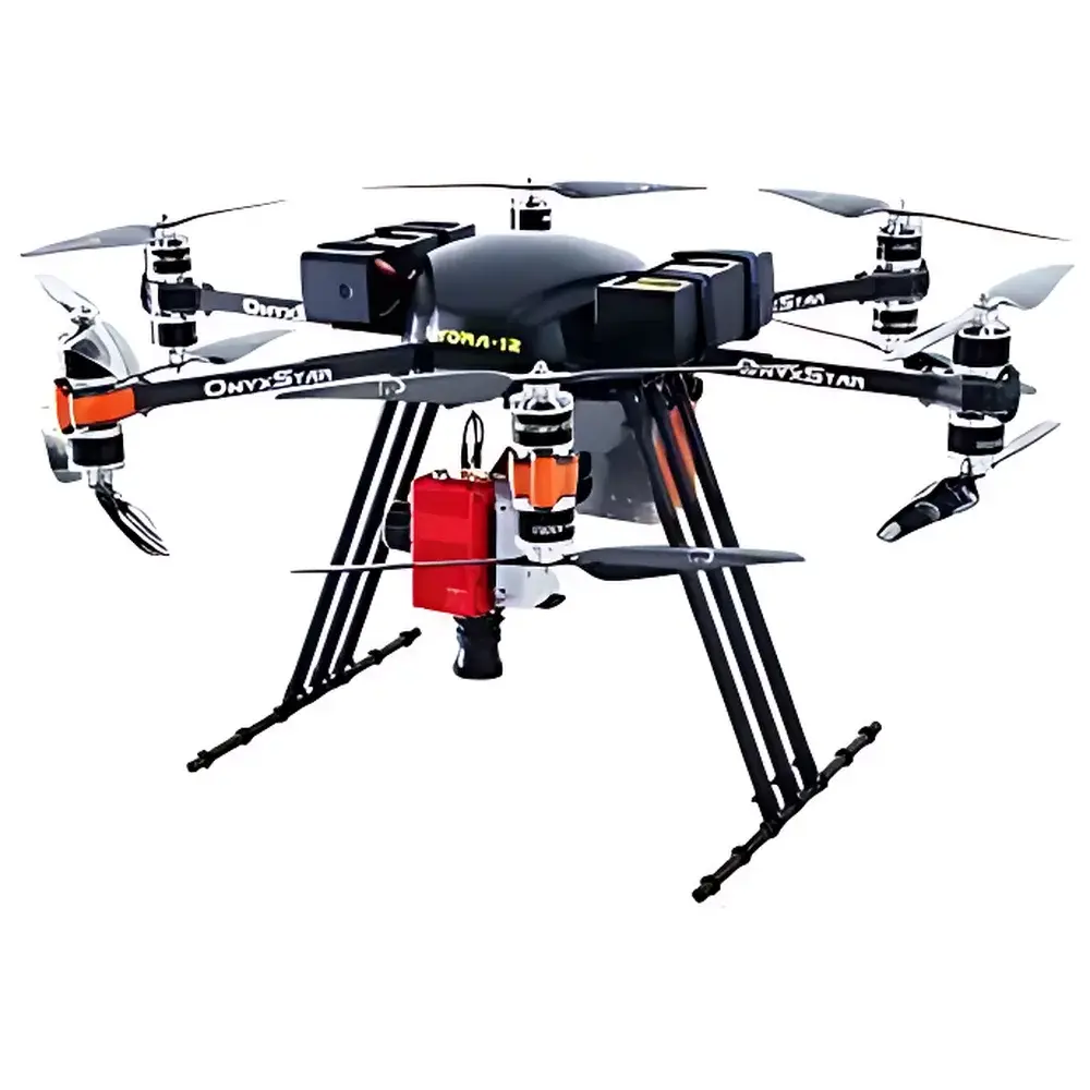
| Platform Compatibility | Ground-based and airborne (fixed-wing, rotary-wing, manned & unmanned aircraft) |
| Spectral Range | 400–1000 nm (VNIR), 600–1600 nm (VNIR-SWIR overlap), 400–2500 nm (full VNIR-SWIR), 7.7–12.3 µm (LWIR) |
| Spectral Resolution | 1.75 nm / 3.5 nm / 7 nm (VNIR), 10 nm / 15 nm (SWIR), 100 nm (LWIR) |
| Spatial Pixels | 2048 (VNIR), 384–1024 (SWIR variants), 616 (LWIR) |
| Field of View (TFOV) | 32° |
| Instantaneous Field of View (IFOV) | Height-dependent |
| Frame Rate | ≥100 fps |
Overview
The Specim AISA Airborne Hyperspectral Imaging System is a field-proven, turnkey solution engineered for high-precision remote sensing applications from aerial platforms. Based on push-broom scanning architecture and dispersive spectroscopy, the AISA platform captures contiguous spectral data across hundreds of narrow bands—enabling pixel-level spectral signatures for material identification, quantification, and spatial mapping. Unlike multispectral systems, AISA delivers continuous spectral coverage across the visible-near infrared (VNIR: 380–1000 nm), shortwave infrared (SWIR: 1000–2500 nm), and longwave infrared (LWIR: 7.7–12.3 µm) domains—each supported by dedicated optical designs and calibrated focal plane arrays. The system’s core measurement principle relies on precise synchronization between linear motion (aircraft velocity), line-scan acquisition, and real-time georeferencing via integrated GNSS/IMU. This ensures sub-pixel geometric accuracy and radiometric stability under dynamic flight conditions—critical for time-series analysis, change detection, and regulatory-grade reporting.
Key Features
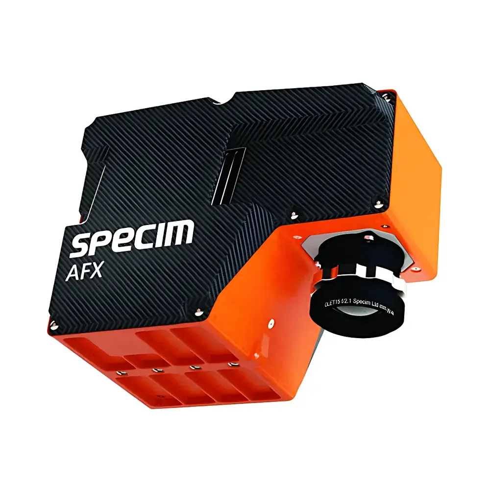
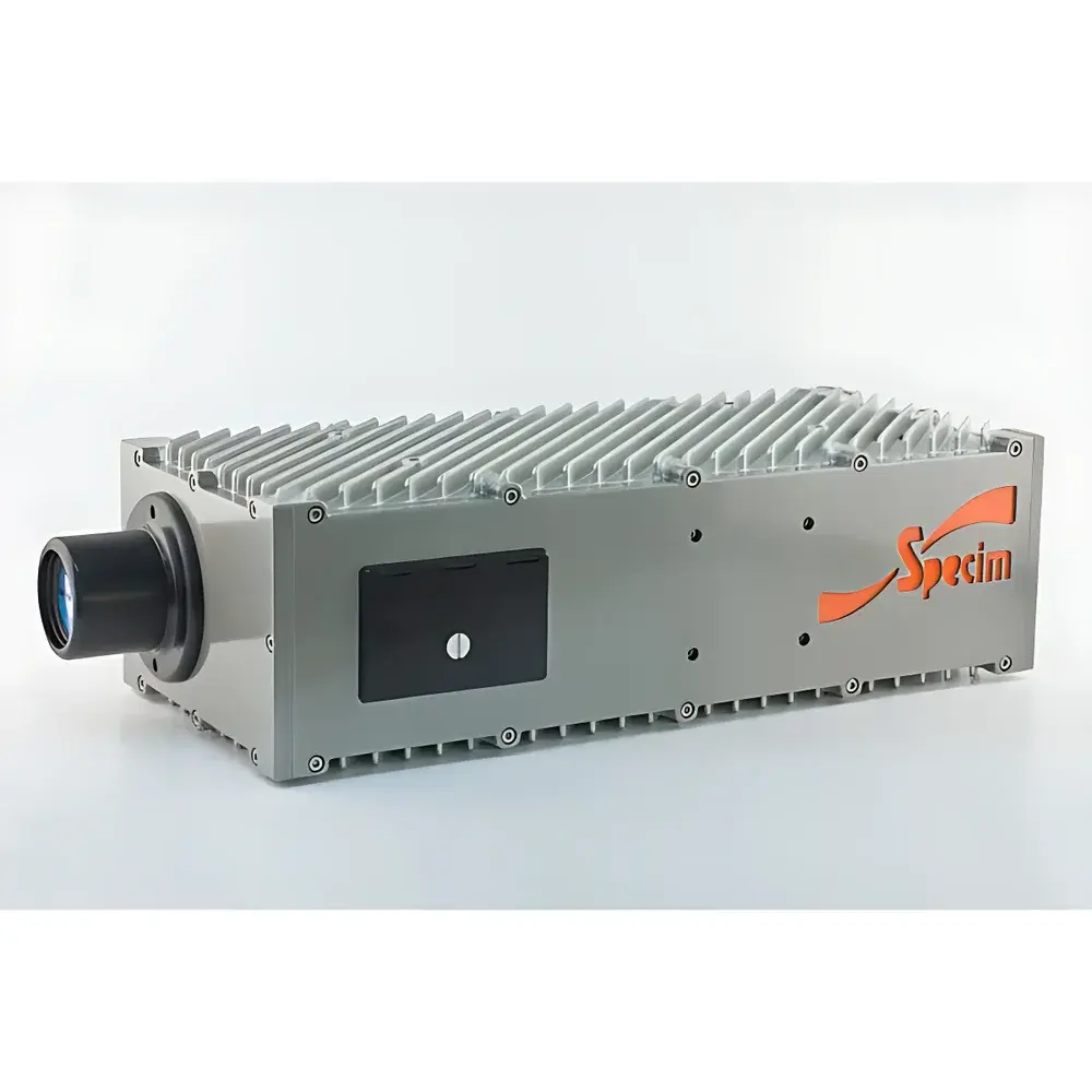
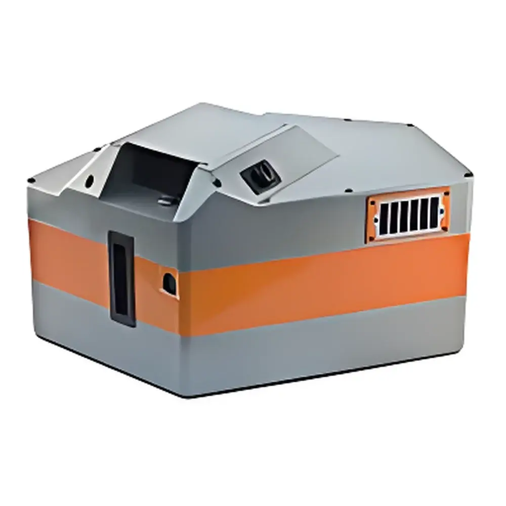
- Modular, application-optimized configurations: AisaFENIX (VNIR-SWIR, 380–2500 nm, single-optics design), AisaFENIX-1K (1024 spatial pixels, enhanced ground sampling distance), AFX series (ultra-compact VNIR/NIR UAV systems <2.5 kg), and FX120 (LWIR thermal hyperspectral imaging)
- High-fidelity radiometric calibration traceable to NIST standards; factory-calibrated reflectance and radiance outputs support quantitative analysis without post-mission empirical correction
- Integrated high-accuracy GNSS/INS (Inertial Measurement Unit) with dual-frequency GPS and tactical-grade gyroscopes—enabling direct georeferencing with ≤10 cm horizontal and ≤5 cm vertical positional uncertainty (RMS, post-processed)
- Real-time onboard data acquisition and storage at ≥100 fps, supporting full-resolution streaming to solid-state recorders with lossless compression (e.g., HDF5 or BIL formats)
- Ruggedized aluminum housing rated IP54; operational temperature range −10°C to +50°C; designed for vibration, shock, and electromagnetic compatibility per MIL-STD-810G and DO-160G
- Unified optical path in AisaFENIX eliminates inter-sensor misregistration—removing need for post-hoc co-registration between VNIR and SWIR channels and ensuring spectral-spatial fidelity across the full 620-band range
Sample Compatibility & Compliance
AISA systems are not sample-contact instruments; they operate non-invasively at standoff distances ranging from 10 m (UAV) to 5 km (manned aircraft). Spatial resolution (GSD) is determined by altitude, lens focal length, and detector pitch—e.g., AisaFENIX-1K achieves ~15 cm GSD at 1,000 m AGL with a 35 mm lens. All AISA configurations comply with EU CE marking requirements for electromagnetic compatibility (EMC Directive 2014/30/EU) and radio equipment (RED 2014/53/EU). Radiometric calibration protocols align with ASTM E2796 (Standard Practice for Spectral Calibration of Hyperspectral Imaging Sensors) and ISO 17321-1 (Imaging spectrometry — Part 1: Vocabulary and basic principles). Data provenance and processing workflows support GLP/GMP-aligned audit trails when used with CaliGeoPro software, including metadata embedding per ISO 19115-2 and compliance-ready export for FDA 21 CFR Part 11–governed environments.
Software & Data Management
Specim provides CaliGeoPro—a validated, modular software suite for end-to-end hyperspectral data handling. It includes radiometric calibration (dark current, flat-field, spectral response), geometric correction (orthorectification using DEM/DSM inputs), atmospheric compensation (QUAC, FLAASH-compatible interfaces), and spectral library matching (USGS, JPL, ECOSTRESS libraries). Data exports support ENVI, PCI Geomatica, Python (rasterio, scikit-image), and MATLAB native formats. Batch processing pipelines are scriptable via Python API; all user actions—including calibration parameter updates and georeferencing refinements—are logged with timestamps, operator ID, and hash-verified metadata—meeting traceability requirements for ISO/IEC 17025-accredited laboratories and environmental monitoring programs governed by EPA Method 184.1.
Applications
- Agriculture & Forestry: Crop health assessment via chlorophyll fluorescence (F760/F685), nitrogen stress mapping, species classification (e.g., conifer vs. deciduous), and early detection of pest infestation (e.g., bark beetle outbreaks) using spectral anomalies in SWIR water absorption bands
- Geological & Mineral Exploration: Identification of hydrothermally altered minerals (e.g., kaolinite, alunite, jarosite) through diagnostic Al–OH and Fe–OH absorption features near 2200 nm; lithological mapping in arid terrains where surface exposure enables direct spectral discrimination
- Environmental Monitoring: Detection of hydrocarbon seeps (via C–H vibrational overtones at 1650–1750 nm), wetland delineation (water index derivation), and post-wildfire burn severity assessment (dNBR calculation from pre-/post-event VNIR-SWIR stacks)
- Defense & Security: Camouflage detection via spectral mismatch analysis against natural background endmembers; concealed object identification using emissivity contrast in LWIR; illicit crop surveillance (e.g., opium poppy) based on unique phenological spectral trajectories
- Urban Infrastructure: Roof material classification (asphalt vs. metal vs. ceramic), solar panel efficiency estimation (via NIR reflectance decay patterns), and heat island mapping using FX120-derived land surface temperature (LST) products
FAQ
What mounting options are available for AISA systems on aerial platforms?
AISA supports standardized hardpoints (ISO 9001-compliant interface plates), gimbal integration (e.g., FLIR Vue Pro R, Phase One iXM), and OEM-ready CAN bus and Ethernet interfaces for seamless avionics integration.
Is real-time onboard processing supported?
While raw data acquisition is real-time, full radiometric and geometric correction requires post-flight processing in CaliGeoPro; however, lightweight edge algorithms (e.g., NDVI, NDWI) can be deployed via optional FPGA acceleration modules.
Can AISA data be used for regulatory reporting (e.g., EPA, EU Copernicus)?
Yes—when acquired and processed under documented SOPs with traceable calibration certificates and version-controlled software, AISA-derived products meet evidentiary requirements for Tier 2 environmental impact assessments and Copernicus Service Level Agreements.
How is spectral calibration maintained during long-term deployments?
Specim recommends annual factory recalibration; field verification is performed using portable reference panels (Spectralon® certified 99% reflectance) and onboard shutter/dark reference cycles before and after each mission.
Does AISA support synchronized multi-sensor operation (e.g., LiDAR + hyperspectral)?
Yes—via PPS-triggered acquisition and time-synchronized IMU/GNSS streams; Specim provides hardware sync modules and timestamp alignment tools compatible with Riegl, Velodyne, and Leica LiDAR systems.
Related Products