Lufft StaRWIS-UMB Non-Contact Road Surface Condition Sensor
| Brand | Lufft |
|---|---|
| Origin | Germany |
| Model | StaRWIS-UMB |
| Measurement Principle | Spectral Reflectance Analysis + Infrared Pyrometry |
| Operating Temperature Range | –40 °C to +70 °C |
| Water Film Thickness Range | 0–6 mm (dual-mode output for smooth & rough surfaces) |
| Ice Coverage Detection | Qualitative & Quantitative (0–100% ice fraction estimation) |
| Surface Temperature Accuracy | ±0.5 °C |
| Friction Coefficient Estimation | Relative index (non-mechanical, algorithm-derived) |
| Optical Source | Long-life LED (no moving parts, >50,000 h MTBF) |
| Communication Interfaces | Bluetooth 5.0 (for configuration & diagnostics), RS-485 (Modbus RTU), CAN-BUS (SAE J1939 compliant) |
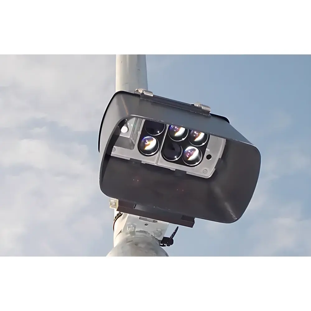
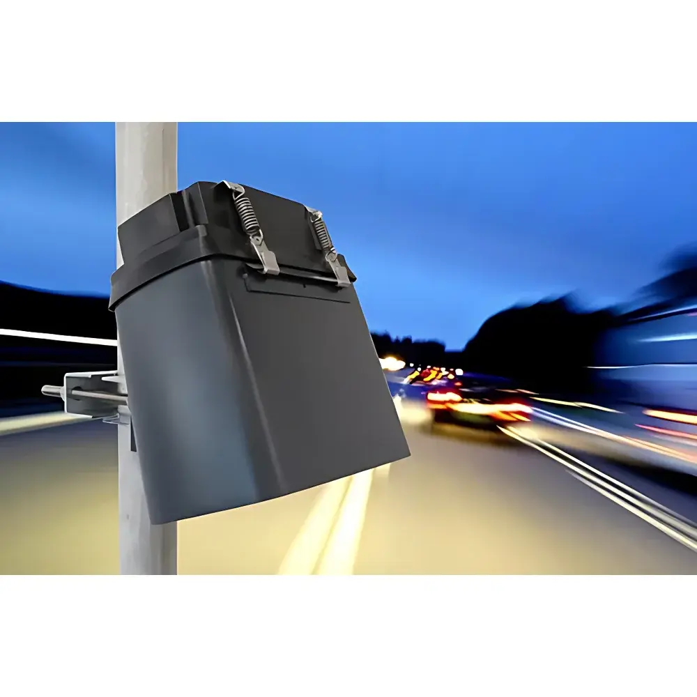
| Mounting | Pole- or gantry-mounted, no road cutting required |
| IP Rating | IP66 |
| Compliance | EN 12830, EN 13193, WMO Guide to Meteorological Instruments and Methods of Observation (CIMO Guide), ISO/IEC 17025 applicable for calibration traceability |
Overview
The Lufft StaRWIS-UMB is a field-deployable, non-contact road surface condition sensor engineered for continuous, all-weather monitoring of critical pavement parameters in intelligent transport infrastructure. It operates on dual physical principles: spectral reflectance analysis in the visible and near-infrared (VIS-NIR) range to classify surface state (dry, wet, damp, icy, snow-covered), and infrared pyrometry to determine absolute surface temperature with high thermal stability. Unlike mechanical or capacitive sensors requiring embedded installation or physical contact, the StaRWIS-UMB uses a fixed optical head mounted above the roadway—eliminating pavement intrusion, minimizing maintenance downtime, and preserving structural integrity. Its robust aluminum housing and sealed optics meet stringent environmental requirements for roadside deployment across climatic zones—from alpine passes to coastal highways—while maintaining metrological consistency under solar loading, precipitation, and wind-induced vibration.
Key Features
- Non-invasive optical sensing architecture: No road cutting, no embedded hardware, no calibration drift from mechanical wear.
- Dual-spectrum water film thickness measurement: Delivers separate, algorithm-validated outputs for smooth asphalt/concrete and textured/rough surfaces—critical for accurate hydroplaning risk assessment per ASTM E1136 and EN 13036-4.
- LED-based illumination system: Engineered for >50,000 hours mean time between failures (MTBF), eliminating lamp replacement cycles common in halogen-based predecessors.
- Integrated dew point and frost point calculation: Derived from concurrent surface temperature and ambient humidity inputs (when paired with compatible weather stations), supporting proactive anti-icing decision logic.
- Multi-interface communication stack: Simultaneous Bluetooth 5.0 (for technician-level field commissioning and firmware updates), RS-485 (Modbus RTU for SCADA integration), and CAN-BUS (SAE J1939 for ITS vehicle-to-infrastructure telemetry).
- Embedded diagnostic logging: Real-time self-monitoring of signal-to-noise ratio, lens contamination status, and internal thermal equilibrium—enabling predictive maintenance scheduling.
Sample Compatibility & Compliance
The StaRWIS-UMB is validated for use on standard bituminous pavements, concrete slabs, steel bridge decks, and rail track beds. Its spectral response has been characterized across representative surface albedos (0.05–0.45) and micro-textures (MTD 0.1–1.2 mm) per EN 13036-1. Regulatory alignment includes compliance with EN 12830 (road weather information systems), EN 13193 (road surface condition classification), and the World Meteorological Organization’s CIMO Guide (Chapter 10, Road Weather Observations). Data traceability supports ISO/IEC 17025-accredited calibration protocols when deployed within certified meteorological networks. The device does not provide legally binding friction values per ISO 10844; rather, it delivers a physics-based relative friction index correlated to tire–pavement interaction models used in road safety analytics.
Software & Data Management
Configuration, real-time visualization, and historical data export are supported via the Lufft SmartView mobile application (iOS/Android), which implements Bluetooth LE secure pairing and AES-128 encrypted parameter transfer. For enterprise integration, the sensor outputs timestamped, ASCII-formatted frames via RS-485 or CAN-BUS—including raw spectral intensities, processed state flags, and derived metrics (e.g., “IceFraction”, “WaterFilmSmooth_mm”, “SurfaceTemp_C”). All firmware revisions adhere to IEC 62443-4-2 security requirements. Audit trails for configuration changes, calibration events, and diagnostic alerts are retained onboard for ≥30 days and exportable in CSV or JSON formats—facilitating GLP-aligned operational documentation and FDA 21 CFR Part 11-compliant environments where road safety data informs regulatory reporting.
Applications
- Traffic management centers: Dynamic variable message sign (VMS) activation based on real-time ice onset detection.
- Bridge deck monitoring systems: Early warning of freeze-thaw cycles and black ice formation using differential surface–air temperature gradients.
- Railway infrastructure operators: Integration with ETCS Level 2/3 signaling to adjust train braking curves in response to detected low-friction segments.
- Smart city mobility platforms: Feeding high-resolution pavement condition data into digital twin models for predictive winter maintenance routing (e.g., salt spreader dispatch optimization).
- Research-grade meteorological networks: Long-term validation of numerical weather prediction (NWP) surface energy balance models at sub-kilometer resolution.
FAQ
Does the StaRWIS-UMB require periodic recalibration?
Yes—annual field verification against NIST-traceable reference surfaces is recommended per EN 12830 Annex C. Factory calibration certificates include uncertainty budgets for all primary outputs.
Can it distinguish between thin frost and dew condensation?
Yes—via combined spectral slope analysis in the 940 nm water absorption band and thermal inertia modeling; frost exhibits higher reflectance contrast and slower temperature equilibration than dew.
Is CAN-BUS output compatible with OEM telematics systems?
Yes—SAE J1939 parameter groups (PGNs) 65245 (surface condition) and 65246 (temperature) are natively supported, with configurable message rate (1–10 Hz).
What mounting height is optimal for reliable detection?
Standard deployment is 3.5–5.0 m above road surface; optical field-of-view covers 0.8 m × 0.8 m at 4 m height, with angular tolerance of ±15° for pitch/yaw misalignment.
How is lens contamination handled during operation?
The device continuously monitors backscatter intensity at 850 nm; contamination alerts trigger at >15% signal attenuation, and cleaning intervals are logged with severity grading (Level 1–3).


")
